 |
|
If you ask an old-time Sonoma Valley resident to tell you where Mount Hood is, he or she will point to a distinctive, blocky, reddish mountain at the northeast end of the Valley of the Moon, not the volcano in Oregon. Mount Hood, or more properly, Hood Mountain, looms up right next to Sugarloaf Ridge.
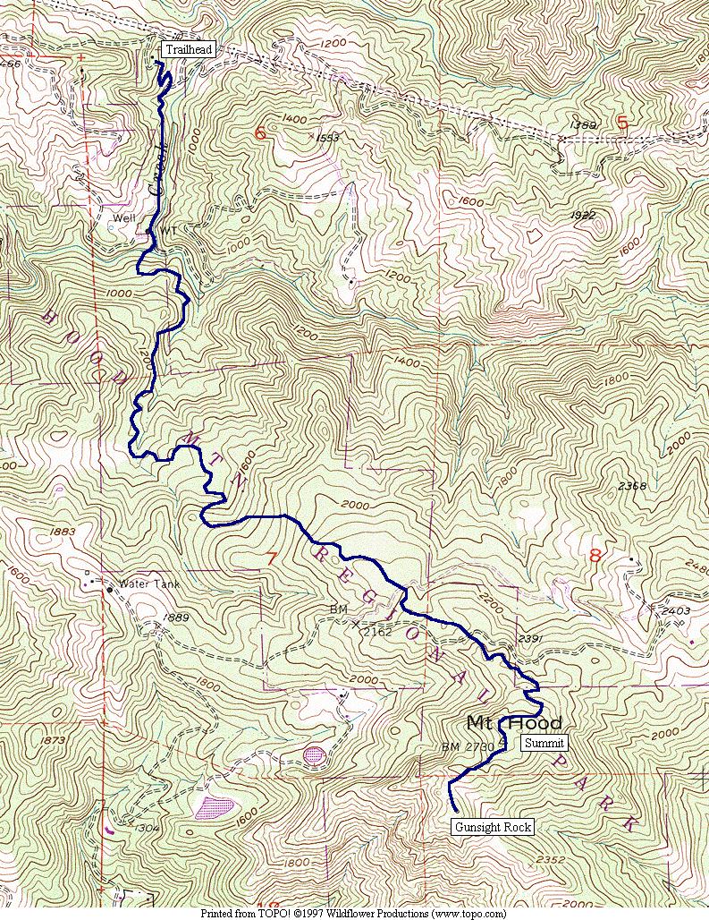
It's distinctive feature, Gunsight Rock, is a blocky notch near the summit. This airy view looks down on the hills and vineyards of Kenwood. On a clear day, you can see it from Richmond, across San Pablo Bay. On a clear February day in 1976, I saw the downtown San Francisco, the Pacific Ocean, and the Sierra Nevada, all in a panorama view from the summit. Hood Mountain is a great destination in it's own right, and it's also a great place to train for High Sierra hiking. The 4.5 mile, 2,400' ascent will definitely get your attention!
This map shows the terrain in good detail, but you should get an official map. The map for Sugarloaf Ridge State Park covers this park, as well. In fact, you can hike from Sugarloaf Ridge to Hood Mountain, although I haven't done it as of this writing.